History of National Weather Service in Timeline

The National Weather Service (NWS) is a federal agency within the National Oceanic and Atmospheric Administration (NOAA) tasked with providing weather, water, and climate data, forecasts, and warnings for the United States. Its primary mission is to protect lives and property while enhancing the national economy. The agency operates a vast network of observation systems, including satellites, radar, and weather stations, to monitor atmospheric conditions. By issuing timely alerts for severe weather events—such as hurricanes, tornadoes, and floods—the NWS serves as the authoritative source for meteorological information. Beyond immediate safety, the NWS supports a wide range of industries, including aviation, agriculture, and maritime commerce, by providing critical insights that inform public and private decision-making. Through its nationwide infrastructure and dedicated meteorologists, the NWS acts as a cornerstone of public safety and environmental intelligence in the United States.
2 days ago : National Weather Service Predicts Storms and Heat Across Georgia
The National Weather Service has issued warnings for Georgia, predicting widespread rain, thunderstorms, and hail alongside dangerous heat levels affecting the region through mid-July.
1937: First Weather Bureau Radiosonde Launch
In 1937, the Weather Bureau successfully launched its first radiosonde in Massachusetts, a milestone that signaled the beginning of a transition from routine aircraft-based weather observations to the more efficient use of radiosonde technology.
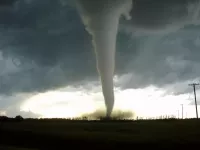
1938: Lifting of the Tornado Reporting Ban
After a long-standing policy of prohibiting the use of the word "tornado" in weather reports to avoid public panic, the Weather Bureau changed its approach in 1938 to begin disseminating official tornado warnings specifically to emergency management personnel.
1940: Transfer to Department of Commerce
In 1940, the Weather Bureau underwent a significant organizational change when it was moved under the jurisdiction of the Department of Commerce.
1941: Hiring of first female statistician
In 1941, Margaret Smagorinsky (née Knoepfel) achieved a historic milestone by becoming the first female statistician hired by the Weather Bureau.
September 23, 1946: Founding of the First River Forecast Center
On September 23, 1946, the first River Forecast Center (RFC) was established, marking the beginning of a network that now includes thirteen centers providing critical daily river and hydrologic forecasting services.
1948: Pioneering of Severe Weather Forecasting
In 1948, Air Force Captain Robert C. Miller and Major Ernest Fawbush pioneered the development of tornado forecasting methods for the USAF Severe Weather Warning Center.
July 12, 1950: Lifting of the public tornado alert ban
On July 12, 1950, Bureau chief Francis W. Reichelderfer issued a circular letter that officially ended the agency's ban on public tornado alerts, instructing employees to maintain a willingness to provide forecasts when there was a good probability of verification.
March 1952: First experimental public tornado forecasts
Following significant public criticism regarding the restriction of tornado data, the Bureau issued its first experimental public tornado forecasts in March 1952.
1957: Implementation of WSR-57 Radar
In 1957, the Bureau began utilizing modified Navy radar technology to create the WSR-57 for short-term forecasting of storms and hydrological events, initiating a nationwide network deployment.
August 1966: Weather Bureau joins ESSA
In August 1966, the Weather Bureau was integrated into the Environmental Science Services Administration (ESSA) as part of a formal agency restructuring.
October 1, 1970: Establishment of the National Weather Service
On October 1, 1970, the Environmental Science Services Administration was renamed the National Oceanic and Atmospheric Administration (NOAA) under the National Environmental Policy Act, officially designating the former Weather Bureau as the National Weather Service.
1970: Renaming of the United States Weather Bureau
In 1970, the agency previously known as the United States Weather Bureau officially adopted its current name, the National Weather Service, to reflect its expanded role in providing meteorological data and public safety warnings.
1974: Introduction of WSR-74 radar models
Beginning in 1974, the Bureau initiated the process of upgrading its existing radar infrastructure to the more advanced WSR-74 models.
1983: Proposed Privatization of NOAA Assets
In 1983, NOAA administrator John V. Byrne proposed the privatization of critical assets including weather satellites, NOAA Weather Radio, and observation stations; however, the plan was rejected by Congress.
1983: Proposal to Privatize NOAA Weather Satellites
In 1983, the Reagan administration and NOAA administrator John V. Byrne proposed selling the agency's weather satellite network to private entities, which would then sell the data back to the government. The 1983 plan also included significant workforce reductions and the outsourcing of weather radio and observation stations, but it ultimately faced widespread opposition and failed to pass Congress.
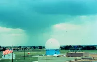
1988: Initiation of NEXRAD Deployment
In 1988, the National Weather Service began the transition to the NEXRAD (Next Generation Radar) system, marking the start of a decade-long process to replace older radar technologies with advanced Doppler radar capabilities to enhance severe storm detection.
1997: Full Deployment of NEXRAD Radar Network
By 1997, the National Weather Service completed the full deployment of the WSR-88D Doppler weather radar system, commonly known as NEXRAD, across the majority of the United States. This milestone established a network of 158 radar sites essential for severe weather monitoring.
1997: Completion of NEXRAD System Rollout
The transition from legacy WSR-57 and WSR-74 radar systems to the modern Doppler-based NEXRAD network was successfully completed in 1997, significantly improving the accuracy and warning lead times for severe local weather events.
October 2000: Establishment of the NOAA Weather Wire Service
In October 2000, the National Weather Service officially established the NOAA Weather Wire Service (NWWS), a satellite-based system designed to distribute critical meteorological, hydrological, and geophysical data to government, media, and private entities with high-speed efficiency.
2005: Introduction of the National Weather Service Duties Act of 2005
In 2005, Pennsylvania Senator Rick Santorum proposed the National Weather Service Duties Act of 2005, which sought to prevent the National Weather Service from providing free weather data to the public. The bill faced significant backlash from emergency management officials and aviation organizations, such as the Aircraft Owners and Pilots Association, who argued that limiting access to this critical information would compromise public safety and aviation operations. Consequently, the bill failed to gain support and died in committee during the 2005 Congressional session.
September 30, 2007: End of Geopolitical Boundary Warnings
On September 30, 2007, the National Weather Service concluded its use of geopolitical boundaries as the primary method for issuing warnings for severe thunderstorms, tornadoes, flash flooding, and marine hazards.
October 1, 2007: Implementation of Storm-Based Warnings
On October 1, 2007, the National Weather Service transitioned to a storm-based warning system, utilizing polygonal shapes on maps to delineate specific areas threatened by meteorological or hydrological hazards based on Doppler radar projections.
April 2012: Introduction of Impact Based Warning System
In April 2012, the National Weather Service launched the Impact Based Warning system as a pilot project across select offices in Kansas and Missouri to provide more detailed hazard reporting and damage potential within weather warnings.
2015: Expansion of Impact Based Warning System
By the spring of 2015, the Impact Based Warning system pilot project was expanded to include 80 Weather Forecast Offices managed by the Central, Eastern, Southern, and Western Region Headquarters.
2016: National Weather Service Organizational Restructuring
In 2016, the National Weather Service finalized its organizational structure to better serve its mission of protecting life and property through weather, water, and climate forecasts.
2016: NWS Supercomputer Upgrade
In 2016, the National Weather Service invested $44 million to acquire two new supercomputers from Cray and IBM to address the inferior accuracy of its Global Forecast System (GFS) model, which had previously failed to predict Hurricane Sandy's landfall trajectory as effectively as European models. This 2016 upgrade significantly bolstered computational capacity from 776 teraflops to 5.78 petaflops.
August 28, 2025: Executive Order Dissolves NWS Employee Union and Reclassifies Agency
On August 28, 2025, President Trump signed an executive order that effectively dissolved the National Weather Service (NWS) Employee Union. This order reclassified the agency as having a primary function related to national security, intelligence, and investigative work, citing the critical importance of weather data in military planning and deployment success.
2025: Impact of NOAA Budget Cuts on the National Weather Service
During 2025, the National Weather Service faced significant operational challenges under the second Donald Trump administration due to substantial budget cuts to NOAA. These actions resulted in staff layoffs, the termination of university research contracts, and limitations on international meteorological cooperation, leaving 30 offices without a chief meteorologist at the start of the 2025 hurricane season.
Mentioned in this timeline

Radar is a radiodetermination system employing radio waves to ascertain...
Weather radar also known as weather surveillance radar or Doppler...
A tornado is a violently rotating column of air extending...
Massachusetts officially the Commonwealth of Massachusetts is a state located...

St Louis is an independent city located in Missouri near...

Kansas a Midwestern U S state is named after the...
Trending
4 hours ago Turkish Airlines Flight TK710 Declares Emergency and Diverts to Baku

4 hours ago Kamaru Usman Faces Dricus du Plessis at UFC Fight Night in Oklahoma City
4 hours ago Anna Leigh Waters Links LeBron James to Portland Trail Blazers at ESPYs

4 hours ago Abdul El-Sayed Gains High-Profile Support Amid Shifting Michigan Senate Primary Dynamics

4 hours ago Bison Attack Leaves Tourist Seriously Injured in Yellowstone National Park

4 hours ago Four Victims Identified After Tragic Volare Yacht Sinking in San Francisco Bay
Popular

Lindsey Graham is a prominent American politician serving as the...

Cristiano Ronaldo widely considered one of the greatest footballers captains...

Mitch McConnell is a prominent American politician and the longest-serving...

Elon Musk is a visionary entrepreneur and engineer known for...

Candace Owens is an American conservative political commentator author and...

Bernie Sanders is a prominent American politician and the senior...