
A polar vortex is a large area of cold, rotating air found near both of Earth's poles, and on other planetary bodies. It's more accurately described as two distinct phenomena: the stratospheric polar vortex and the tropospheric polar vortex. Both rotate in the direction of the Earth's spin, but differ in size, structure, seasonal cycles, and their effects on weather patterns. Thus, it is important to recognize the distinction between the two when discussing the impact of the polar vortex.
1952: Discovery of Stratospheric Sudden Warmings (SSWs)
In 1952, Stratospheric Sudden Warmings (SSWs) within the stratospheric vortex were discovered through radiosonde observations at altitudes higher than 20 km.
1960: Jet Streams Polewards since 1960
A 2021 study found that jet streams had indeed slowly moved polewards since 1960 as was predicted by models, they did not weaken, in spite of a small increase in waviness.
1979: Start of the Poleward Movement of Jet Stream
From 1979, the northern jet stream started to move northward at an average rate of 2.01 kilometres (1.25 mi) per year until 2001.
1980: Target Level for Ozone
It is expected that Ozone will return to 1980 levels in about 2075.
1985: Winter 1985 Arctic Outbreak
During the Winter 1985 Arctic outbreak, subtropical air masses intruded poleward causing the Arctic air masses to move equatorward, when the Arctic pattern was at its weakest.
1997: Suggestion that the Polar Vortex Causes More Unstable Weather
Paleoclimate reconstructions suggested back in 1997 that the polar vortex becomes more variable and causes more unstable weather during periods of warming.
2001: Statistical Correlation Between Weak Polar Vortex and Severe Cold
In 2001, researchers found a statistical correlation between a weak polar vortex and outbreaks of severe cold in the Northern Hemisphere.
2001: End of the Period for Measuring the Poleward Movement of Jet Stream
Until 2001, the northern jet stream moved northward at an average rate of 2.01 kilometres (1.25 mi) per year since 1979.
2002: Jet Stream Strength
A 2022 re-analysis of the aircraft observational data collected over 2002–2020 suggested that the North Atlantic jet stream had actually strengthened.
2003: Stalling Rossby Waves in Weather Events
Studies identified stalling patterns of Rossby waves in the northern hemisphere jet stream as the culprit behind the 2003 European heat wave and other almost stationary extreme weather events.
2008: Confirmation of Poleward Movement of Northern Jet Stream
In 2008, observational evidence confirmed that from 1979 to 2001, the northern jet stream moved northward at an average rate of 2.01 kilometres (1.25 mi) per year.
2009: Severe Cold in the UK Blamed on Polar Vortex
The severe cold in the United Kingdom in the winter of 2009 was blamed on the polar vortex.
2010: Climate Modelling Findings Contradicting Polar Vortex
In 2010, climate modelling (PMIP2 simulations) found that the Arctic Oscillation (AO) was much weaker and more negative during the Last Glacial Maximum, suggesting that warmer periods have stronger positive phase AO, and thus less frequent leaks of the polar vortex air.
2010: Sea Ice Decline Found to Weaken the Jet Stream
State-of-the-art modelling research of PAMIP improved upon the 2010 findings of PMIP2; it found that sea ice decline would weaken the jet stream and increase the probability of atmospheric blocking.
2010: Stalling Rossby Waves in Weather Events
Studies identified stalling patterns of Rossby waves in the northern hemisphere jet stream as the culprit behind the 2010 Russian heat wave or the 2010 Pakistan floods, and suggested that these patterns were all connected to Arctic amplification.
2010: Severe Cold in the UK Blamed on Polar Vortex
The severe cold in the United Kingdom in the winter of 2010 was blamed on the polar vortex.
2011: Arctic Ozone Hole
In 2011, chemical ozone destruction in the Arctic polar vortex reached a level identifiable as an Arctic "ozone hole" for the first time.
2012: Francis-Vavrus Hypothesis Proposed
In 2012, Jennifer Francis and Stephen J. Vavrus proposed a hypothesis suggesting a link between a more variable polar vortex and more unstable weather during periods of warming.
2013: CMIP5 Underestimates Winter Blocking Trends
In 2013, a study noted that the then-current CMIP5 tended to strongly underestimate winter blocking trends.
2013: Francis Connects Arctic Sea Ice Reductions to Extreme Summer Weather
In 2013, research from Francis connected reductions in the Arctic sea ice to extreme summer weather in the northern mid-latitudes, while other research from that year identified potential linkages between Arctic sea ice trends and more extreme rainfall in the European summer.
2013: Increased Media Mention of Tropospheric Polar Vortex
In 2013, the tropospheric polar vortex was frequently mentioned in the news and weather media, particularly during the cold North American winter, popularizing the term to explain very cold temperatures.
2013: Jet Stream Direction in the Western United States
In the winter of 2013, the polar jet stream took a significant northwestward direction in the western part of the United States. This caused warm, dry conditions in the west, and cold, snowy conditions in the north-central and northeast.
2013: Reviews Stressing the Need for Long-Term Climatology Observations
Reviews in 2013 stressed that climatology observations require several decades to definitively distinguish various forms of natural variability from climate trends.
2013: UK Floods Blamed on Polar Vortex
The 2013 United Kingdom winter floods were attributed to the polar vortex, which brought severe cold in the United States and Canada.
2014: Arctic Amplification Decreases Cold-Season Temperature Variability
A 2014 study concluded that Arctic amplification significantly decreased cold-season temperature variability over the northern hemisphere in recent decades.
2014: Connection Between Arctic Amplification and Hurricane Sandy Formation
In early 2014, it was suggested that the connection between Arctic amplification and jet stream patterns played a role in the formation of Hurricane Sandy and in the early 2014 North American cold wave.
2014: Jet Stream Direction in the Western United States
In the winter of 2014, the polar jet stream took a significant northwestward direction in the western part of the United States. This caused warm, dry conditions in the west, and cold, snowy conditions in the north-central and northeast.
2015: Francis Concludes Amplified Jet-Stream Patterns are Occurring More Frequently
In 2015, Francis' study concluded that highly amplified jet-stream patterns are occurring more frequently in the past two decades. Hence, continued heat-trapping emissions favor increased formation of extreme events caused by prolonged weather conditions.
2015: Jet Stream Direction in the Western United States
In the winter of 2015, the polar jet stream took a significant northwestward direction in the western part of the United States. This caused warm, dry conditions in the west, and cold, snowy conditions in the north-central and northeast.
2017: Shift in Polar Vortex States Accounts for Winter Cooling Trends
In a 2017 study by climatologist Judah Cohen, it was suggested that the shift in polar vortex states can account for most of the recent winter cooling trends over Eurasian midlatitudes. Another 2017 paper estimated that when the Arctic experiences anomalous warming, primary production in North America goes down by between 1% and 4% on average, with some states suffering up to 20% losses.
2017: Reviews Stressing the Need for Long-Term Climatology Observations
Reviews in 2017 stressed that climatology observations require several decades to definitively distinguish various forms of natural variability from climate trends.
2017: Identification of Stalling Rossby Waves
Studies published in 2017 identified stalling patterns of Rossby waves in the northern hemisphere jet stream as the culprit behind other almost stationary extreme weather events.
2018: Arctic Amplification Linked to Hot-Dry Extremes and Continental Cooling
A 2018 paper from Vavrus and others linked Arctic amplification to more persistent hot-dry extremes during the midlatitude summers, as well as the midlatitude winter continental cooling.
2018: Stalling Rossby Waves in Weather Events
Studies published in 2018 identified stalling patterns of Rossby waves in the northern hemisphere jet stream as the culprit behind the 2018 European heatwave and other almost stationary extreme weather events.
January 2019: Deep Freeze Blamed on Polar Vortex
In late January 2019, a deep freeze gripped much of the United States and Canada, and was attributed to a "polar vortex", resulting in severe frostbite warnings, school closures, and approximately 21 deaths in the US. Windchills in the midwest region of the United States went just above -50 °F (-45 °C).
2019: Sharp Decrease in Northern Midlatitude Cold Waves
A 2019 analysis found a sharp decrease in northern midlatitude cold waves since the 1980s.
2020: Jet Stream Strength
A 2022 re-analysis of the aircraft observational data collected over 2002–2020 suggested that the North Atlantic jet stream had actually strengthened.
2020: No Significant Changes on Mid-latitude Atmospheric Patterns
A range of long-term observational data collected during the 2010s and published in 2020 suggests that the intensification of Arctic amplification since the early 2010s was not linked to significant changes on mid-latitude atmospheric patterns.
February 2021: Stratospheric Polar Vortex Disruption Linked to Cold Winter Weather
A 2021 study found that a stratospheric polar vortex disruption is linked with extreme cold winter weather across parts of Asia and North America, including the February 2021 North American cold wave.
2021: Jet Streams Move Polewards
A 2021 study found that while jet streams had indeed slowly moved polewards since 1960 as was predicted by models, they did not weaken, in spite of a small increase in waviness. Another 2021 study was able to reconstruct jet stream patterns over the past 1,250 years based on Greenland ice cores, and found that all of the recently observed changes remain within range of natural variability
2021: Arctic Warming Nearly Four Times Faster Than Global Average
In 2021, research found that since 1979, the warming within the Arctic Circle has been nearly four times faster than the global average.
2021: Public Visibility Increase of Tropospheric Vortex
In 2021, the tropospheric vortex gained increased public visibility due to extreme frigid temperatures in the central United States, with newspapers linking its effects to climate change.
2022: Jet Stream Strength
A 2022 re-analysis of the aircraft observational data collected over 2002–2020 suggested that the North Atlantic jet stream had actually strengthened.
2022: Arctic Warming Analysis
In 2022, it was found that since 1979, the warming within the Arctic Circle has been nearly four times faster than the global average, and some hotspots in the Barents Sea area warmed up to seven times faster than the global average.
2060: Earliest Likely Time of Divergence
A 2021 study was able to reconstruct jet stream patterns over the past 1,250 years based on Greenland ice cores, and found that all of the recently observed changes remain within range of natural variability: the earliest likely time of divergence is in 2060, under the Representative Concentration Pathway 8.5 which implies continually accelerating greenhouse gas emissions.
2075: Ozone Expected to Return to 1980 Levels
It is expected that Ozone will return to 1980 levels in about 2075.
Mentioned in this timeline
The United States of America is a federal republic primarily...

The rapid advancement of artificial intelligence continues to dominate the...

Canada is a North American country spanning from the Atlantic...

Pakistan officially the Islamic Republic of Pakistan is a South...

Climate change refers to long-term shifts in global temperatures and...

Greenland is an autonomous territory within the Kingdom of Denmark...
Trending
3 hours ago Tropical Storm Arthur Development Monitored Across Atlantic Basin
3 hours ago Virginia GOP Candidates Compete to Challenge Incumbent Senator Mark Warner in 2026

3 hours ago Benny Safdie Discusses His Role and Experience in New Film The Odyssey

3 hours ago Real Salt Lake Apologizes to Kealia Ohai After JJ Watt Criticism

4 hours ago Jon Elmore Makes Impact During 2026 NBA Summer League Performance
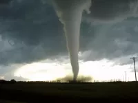
4 hours ago Tornado Warning Issued for Burlington and Ocean Counties in New Jersey
Popular

Lindsey Graham is a prominent American politician serving as the...

Cristiano Ronaldo widely considered one of the greatest footballers captains...

Mitch McConnell is a prominent American politician and the longest-serving...

Elon Musk is a visionary entrepreneur and engineer known for...

Candace Owens is an American conservative political commentator author and...

Bernie Sanders is a prominent American politician and the senior...