
Mount Rinjani, located on the island of Lombok in Indonesia, is an active volcano and the second-highest in the country, reaching 3,726 meters. A significant feature is its large caldera containing Segara Anak lake, approximately 2,000 meters above sea level, and hot springs. The volcano and lake hold cultural and religious importance for the local Sasak people and some Hindus. Rinjani's caldera is part of the UNESCO Global Geoparks Network. The volcano's 1257 eruption was one of the largest in the past 2000 years.
December 1944: Significant event with VEI rating of 2
In December 1944, Rinjani had a significant event with activity rated 2 on the Volcanic Explosivity Index (VEI). Eruptive activity occurred in an area on the north west flank of Barujari (Rombongan).
1944: Eruption at Rombongan dome
In 1944, an eruption occurred at the Rombongan dome, involving moderate explosive activity and lava flows entering Segara Anak lake.
January 1945: Significant event activity continues
In January 1945, Rinjani's significant event from December 1944 continued with activity rated 2 on the Volcanic Explosivity Index (VEI). Eruptive activity occurred in an area on the north west flank of Barujari (Rombongan).
March 1966: VEI 1 eruption begins
In March 1966, Rinjani's eruptive history indicates activity with a Volcanic Explosivity Index (VEI) rating of 1. The area of activity was the east side of Barujari at 2,250 m.
August 1966: VEI 1 eruption ends
By August 8, 1966, the Rinjani eruption, which began in March 1966, had a VEI rating of 1. It produced 6.6 million cubic meters of lava and 20,000 cubic meters of tephra.
August 1966: No significant activity since August 1966
In May 1994, a glow was noticed on the crater floor of Barujari cone, which at this time had undergone no significant activity since August 1966.
May 1994: Glow noticed on Barujari crater floor
In May 1994, a glow was noticed on the crater floor of Barujari cone. One volcanic earthquake event/day was recorded on 27, 28, 30, and 31 May. A portable seismograph (PS-2) and telemetry seismograph (Teledyne) were put into operation on 27 May and 9 June, respectively.
June 1994: Explosions occurred on Rinjani
During June 1994 explosions occurred on Rinjani from the Barujari volcano.
June 1994: Increased Volcanic Activity and Explosions
In June 1994, Barujari cone began erupting, sending an ash plume 500 m high on June 3. Between 3 and 10 June 1994, up to 172 explosions could be heard each day. During this period, seismic data indicated a dramatic increase in the number of explosions per day, from 68 to 18,720. Eruptions were continuous through 19 June 1994, with maximum ash plume heights of 2,000 m on 9–11 June 1994.
June 1994: Increased Eruptive Activity
In June 1994, Rinjani's eruptive history indicates activity accorded a Volcanic Explosivity Index (VEI) with a rating of 3(?). There was a central vent eruption with an explosive eruption, with pyroclastic flow(s), lava flow(s), fatalities and mudflow(s) (lahars).
November 1994: Eruptive Activity continues
In November 1994, Rinjani's eruptive history indicates activity accorded a Volcanic Explosivity Index (VEI) with a rating of 3(?). There was a central vent eruption with an explosive eruption, with pyroclastic flow(s), lava flow(s), fatalities and mudflow(s) (lahars).
November 1994: Fatal lahar flow down Kokok Jenggak River
On November 3, 1994, a cold lahar from Rinjani's summit traveled down the Kokok Jenggak River, killing thirty people. One person remained missing as of November 9, 1994. Local volcanologists warned of potential additional lahars from heavy rainfall.
November 1994: Deadly lahar flow
On November 3, 1994, a cold lahar from the summit of Rinjani traveled down the Kokok Jenggak River, killing thirty people from Aikmel village.
1994: Eruption at Gunung Baru
In 1994, Gunung Baru (New Mountain) in the center of the Rinjani caldera experienced eruptions, leading to lava flows entering the lake.
1994: Spate of activity leads to development of Gunung Barujari
In 1994, a spate of activity started which resulted in the further development of Gunung Barujari.
January 1995: Explosions continue on Rinjani
During January 1995 explosions continued on Rinjani from the Barujari volcano.
September 1995: Unconfirmed ash cloud reported
In September 1995, an aviation report noted an unconfirmed ash cloud from Rinjani. On September 12, a NOTAM indicated a volcanic ash cloud drifting southwest at around 4 km altitude.
1995: Eruption at Gunung Baru continues
In 1995, eruptions continued at Gunung Baru in the Rinjani caldera, with lava flows entering the lake.
1995: Spate of activity continues
In 1995, the spate of activity continued leading to the further development of Gunung Barujari.
1997: Establishment of Gunung Rinjani National Park
In 1997, the Gunung Rinjani National Park was established to protect the volcano and its caldera.
2003: Discovery of the Rinjani scops owl
In 2003, the Rinjani scops owl was found, leading to 10 years of research that eventually recognized it as a new endemic species. Specimens had been collected in the 19th century but misidentified.
May 2004: VEI 2 Rating issued
A Volcanic Explosivity Index (VEI):2 rating was issued for the activity between 1 May 2004 through to (on or after) 5 October 2004.
August 2004: Rise in the number of tectonic earthquakes
During the last third of 2004, the number of volcanic and tectonic earthquakes increased, following a rise in the number of tectonic earthquakes that began on 18 August 2004.
September 2004: Hazard status increased to Alert Level 2
On September 27, 2004, the DVGHM increased Rinjani's hazard status to VEI Alert Level 2 (Yellow). An increase in volcanic and tectonic earthquakes followed a rise in tectonic earthquakes that began August 18, 2004. Tremor was registered on 23-26 September, with amplitudes between 12 and 13.5 mm.
October 2004: Eruption and hazard status raised to Alert Level 3
On October 1, 2004, Rinjani erupted, causing authorities to raise the hazard status to Alert Level 3 (Orange). During 2-5 October 2004, explosions sent ash columns 300-800 m above the summit.
2004: World Legacy Award from Conservation International and Traveller
In 2004, Mount Rinjani National Park received the World Legacy Award from Conservation International and Traveller.
2005: Tourism for Tomorrow Awards finalist
In 2005, Mount Rinjani National Park was a finalist for the Tourism for Tomorrow Awards from the World Travel Tourism Council (WTTC).
2008: Tourism for Tomorrow Awards finalist
In 2008, Mount Rinjani National Park was a finalist for the Tourism for Tomorrow Awards from the World Travel Tourism Council (WTTC).
April 2009: Gunung Barujari becomes active
On April 27, 2009, Gunung Barujari became active, with activity continuing through to May 2009. The mountain was closed, and eruptions intensified with plumes of smoke and ash as high as 8,000 m.
May 2009: Gunung Barujari continues to be active
In May 2009, Gunung Barujari remained active following the activity that began in April. The mountain was closed, and eruptions intensified with plumes of smoke and ash as high as 8,000 m.
May 2009: Alert status raised to 'be vigilant'
Since May 2, 2009, in connection with the eruption of Gunung Barujari cone, the alert status for Gunung Rinjani was raised from Normal to 'be vigilant' (VEI Level 2).
July 2009: Summit route closure due to volcanic activity
In July 2009, the summit route of Mount Rinjani was closed due to increased volcanic activity. The route was subsequently reopened after the activity decreased.
December 2009: Activity Rating Issued
A Volcanic Explosivity Index (VEI):2 rating was issued for the activity between 2 May 2009 and 20 December 2009.
February 2010: Plume observed from Gunung Rinjani
In February 2010, observers saw a whitish plume rising 100 meters from Gunung Rinjani.
March 2010: Dense plumes observed
In March 2010, dense whitish plumes (and possibly brown) rose 500 to 900 m on 26 occasions.
April 2010: High plumes observed
In April 2010, plumes rose as high as 1,500 m on 41 occasions.
May 2010: Standby status declared
In May 2010, Gunung Rinjani was placed in standby status, with a 4 km exclusion zone from the eruption at Gunung Barujari.
May 2010: Most recent eruption of Mount Rinjani
In May 2010, the most recent eruption of Mount Rinjani occurred, contributing to the further development of Gunung Barujari.
May 2010: "Chocolate" colored plumes observed
On May 1 and 2, 2010, plumes were "chocolate" in color and rose a maximum height of 1,600 metres.
May 2010: Column of smoke observed
On May 1, 2010, a column of smoke was observed rising from G. Rinjani "issuing eruptions 1300–1600 metres tall with thick brown color and strong pressure". On May 1, 2010, four explosive earthquake events were recorded with a maximum amplitude of 6–53 mm.
May 2010: Alert Level raised to 2
On May 2, 2010, the Volcanic Explosivity Index (VEI) Alert Level was raised to 2 (Advisory). Based on satellite imagery analysis, the Darwin VAAC reported a possible ash plume rising to 5.5 km altitude on May 5, drifting 150 km NW.
May 2010: Three eruptions damage crops
On May 22, 2010, Rinjani erupted three times, continuing into May 23. Ash rose up to two kilometers into the atmosphere and damaged crops. Lava flowed into the caldera lake, raising its temperature, and smoke spread 12 km.
May 2010: Restricted access to Rinjani due to volcanic activity
Up to and including May 2010, access to Mount Rinjani was intermittently restricted due to ongoing volcanic activity.
October 2015: Mount Rinjani erupts again
On October 31, 2015, Mount Rinjani started erupting again.
April 2018: UNESCO Global Geoparks Network inclusion
In April 2018, UNESCO recognized Mount Rinjani Caldera's significance by including it as part of the Global Geoparks Network.
July 2018: Earthquake causes landslides
On July 29, 2018, a magnitude 6.4 earthquake caused landslides on the north portion of Mount Rinjani.
August 2018: Second earthquake strikes Lombok
On August 5, 2018, a second earthquake struck Lombok, causing more landslides and small tsunamis. The area around Rinjani was evacuated due to concerns of a possible eruption.
Mentioned in this timeline
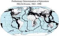
An earthquake is a sudden shaking of the Earth's surface...
Satellites often spacecraft are objects intentionally placed into orbit around...
Travel involves the movement of people between geographical locations using...

UNESCO is a specialized agency of the United Nations UN...

September is the ninth month of the year in the...
Cloud computing is the on-demand delivery of computing services including...
Trending

3 hours ago Millie Bobby Brown Addresses Harsh Criticism and Double Standards Regarding Her Appearance
3 hours ago GOES-19 Weather Satellite Faces Outage Amidst Canadian Wildfire Smoke Concerns

3 hours ago Julia Garner and Husband Mark Foster Announce Separation After Six Years of Marriage

3 hours ago Adam Lambert Reflects on Financial and Personal Success Touring with Queen
3 hours ago Armed Florida Agents Confront Veteran Over Critical Political Postcard

3 hours ago James Talarico Unveils Border Security Plan and Discusses Key Policy Priorities
Popular

Lindsey Graham is a prominent American politician serving as the...

Mitch McConnell is a prominent American politician and the longest-serving...

Cristiano Ronaldo widely considered one of the greatest footballers captains...

Elon Musk is a visionary entrepreneur and engineer known for...

Candace Owens is an American conservative political commentator author and...

Bernie Sanders is a prominent American politician and the senior...