History of Severe thunderstorm warning in Timeline

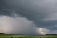
A severe thunderstorm warning is issued by weather agencies when severe thunderstorms are detected or reported, indicating an imminent threat to the areas in its path, typically within an hour. These storms can cause damage and injury due to large hail, high winds, and flooding from heavy rainfall. The criteria for issuing a warning vary by country, but the purpose is to alert the public to take immediate precautions against the approaching severe weather.
October 2007: Change in severe weather warning issuance
Prior to October 2007, the National Weather Service issued severe weather warnings on a per-county basis. After October 2007, warnings for tornadoes and severe thunderstorms were outlined in polygonal shapes, and were issued by individual counties, parishes or other county-equivalent jurisdictions.
January 2010: Hail size upgrade for severe thunderstorm classification
In January 2010, the National Weather Service (NWS) upgraded the hail size criteria for a thunderstorm to be considered severe from 0.75 inches to one inch (2.5 cm) in diameter. This change was motivated by public complacency due to frequent warnings and studies showing hail damage was not significant until it reached one inch.
March 2012: Implementation of Impact Based Warning (IBW) system
In March 2012, the National Weather Service implemented a multi-tier Impact Based Warning (IBW) system. The system notifies the public and emergency management officials of the severity of specific severe weather phenomena, providing summarical estimates of straight-line wind speeds and hail size, including indications of possible tornadic development. Initially, the IBW was implemented at six NWS offices in Kansas and Missouri.
March 2013: Expansion of Impact Based Warning (IBW) system
In March 2013, the categorical threat and damage indicator text of the Impact Based Warning (IBW) system was expanded to 33 additional Central Region Weather Forecast Offices (WFOs). These offices primarily operated within the agency's Central and Southern Region divisions.
2013: Introduction of categorical criteria for severe thunderstorm warnings
In 2013, similar to tornado warnings, categorical criteria was introduced to severe thunderstorm warnings to explain the dangers of some thunderstorms. This system alerts the public of thunderstorms, especially those in the Great Plains, that can produce massive hailstones and winds that can cause damage equivalent to hurricanes and tornadoes. Severe Weather Statement updates containing the "destructive" tag will be disseminated into the Wireless Emergency Alerts system.
March 2014: Further expansion of Impact Based Warning (IBW) system
In March 2014, eight additional Weather Forecast Offices (WFOs) operating within the Eastern, Southern, and Western Region divisions began using the Impact Based Warning (IBW) indicators.
2016: Full agency implementation of Impact Based Warning (IBW) system
In 2016, the Impact Based Warning (IBW) system was adopted by the entire National Weather Service agency. Threat indicators consist of three coded taglines, ascending by observational level.
August 16, 2019: Inclusion of "emergency" wording in a Severe Thunderstorm Warning
On August 16, 2019, the National Weather Service in Cheyenne, Wyoming, included the "emergency" wording into a Severe Thunderstorm Warning at 1:31 a.m. MDT. This "severe thunderstorm emergency" statement was used because three-inch diameter hail was imminent in parts of Scotts Bluff, Banner, and Sioux Counties in Nebraska, specifically around Scottsbluff and Gering.
July 28, 2021: Incorporation of categorical damage threat indicators
Starting July 28, 2021, the NWS began incorporating categorical damage threat indicators for higher-end hail and/or wind events at the bottom of text products for severe thunderstorm warnings, including update statements issued as Severe Weather Statements.
Mentioned in this timeline
A thunderstorm also called an electrical or lightning storm is...

The National Weather Service NWS is a federal agency within...

Kansas a Midwestern U S state is named after the...

Wyoming located in the Mountain West region of the US...
Nebraska located in the Midwestern United States is the th...
Trending

3 hours ago Matteo Berrettini Faces Mariano Navone at National Bank Open Round of 128

3 hours ago Rafael Jódar Competes in ATP 500 Washington Final Amid Weather Delays

3 hours ago Katie Boulter faces Kayla Cross in WTA Toronto 2026 opening round

3 hours ago Chicago Cubs Target Reid Detmers Following Recent MLB Trade Deadline Shifts

3 hours ago Jake and Romy Reiner Honor Parents with Ceremonial First Pitch at Dodgers Game
3 hours ago Bianca Andreescu Makes Emotional Return to Canadian Open in Toronto
Popular

Rand Paul is an American politician and the junior United...

Anthony Stephen Fauci is a prominent American physician-scientist and immunologist...

Lindsey Graham is a prominent American politician serving as the...

Josh Hawley is an American politician and attorney currently serving...

Bernie Sanders is a prominent American politician and the senior...

Johnny Depp is a highly successful American actor musician and...