
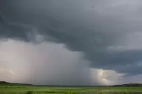
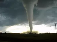
A derecho is a widespread and long-lived straight-line windstorm. It's associated with a fast-moving group of severe thunderstorms called a mesoscale convective system. Derechos are defined by their straight-line winds, distinguishing them from tornadoes which have rotating winds.
May 1998: Upper Middle West-Canada-New York State derecho
In May 1998, a derecho occurred in the upper Middle West, Canada, and New York State. It was one of the most common instances of severe weather outbreaks that may become less favorable to tornado production as they become more violent.
September 1998: Late-summer derecho strikes New York State area
In September 1998, a late-summer derecho struck upper parts of the New York State area after midnight, highlighting that late-year derechos are not always confined to Texas and the Deep South.
July 2002: Serial derecho in Germany
On July 10, 2002, a serial derecho in Germany killed eight people and injured 39 near Berlin, demonstrating that derechos can occur outside of North America.
2003: Significant tornado and severe weather outbreaks
In 2003, significant tornado and severe weather outbreaks occurred, which were examples of situations during which the rare Particularly Dangerous Situation severe thunderstorm variety of severe weather watches were issued from the Storm Prediction Center of the U.S. National Oceanic & Atmospheric Administration.
2004: Significant tornado and severe weather outbreaks
In 2004, significant tornado and severe weather outbreaks occurred, which were examples of situations during which the rare Particularly Dangerous Situation severe thunderstorm variety of severe weather watches were issued from the Storm Prediction Center of the U.S. National Oceanic & Atmospheric Administration.
May 2009: Southern Midwest derecho
In May 2009, a derecho occurred in the Southern Midwest, further exemplifying the hurricane-like radar signatures that some derechos develop, including a central eye and surrounding bands of convection.
August 2010: Derecho strikes Estonia
On August 8, 2010, a derecho struck Estonia and tore off the tower of Väike-Maarja Church, further demonstrating the global occurrence of derechos.
June 2012: North American derecho causes widespread power outages
In June 2012, a North American derecho took out electrical power to more than 3.7 million customers, starting in the Midwestern United States, across the central Appalachians, into the Mid-Atlantic States during a heat wave.
August 2020: Midwest Derecho causes extensive damage
In August 2020, the Midwest Derecho delivered winds up to 63 m/s in the Cedar Rapids, Iowa area, damaging or destroying ten million acres of crops, and leaving over a million homes without basic services. The derecho caused over $7.5 billion in damages.
January 11, 2022: NOAA and Environment and Climate Change Canada revise derecho criteria
On January 11, 2022, the National Oceanic and Atmospheric Administration and Environment and Climate Change Canada formally revised the criteria for a storm to be classified as a derecho. A wind storm must meet the revised criteria.
May 2022: Derecho in southern Ontario and western Quebec
In May 2022, a derecho in southern Ontario and western Quebec caused 10 deaths and $875 million in property damage, reaching peak wind speeds of 190 km/h. The derecho was the sixth largest "insured loss event" in Canadian history.
Mentioned in this timeline

Radar Radio Detection and Ranging is a detection system that...

Germany officially the Federal Republic of Germany is located in...

Chicago situated on Lake Michigan's western shore is the most...
A thunderstorm also called an electrical or lightning storm is...
A tornado is a violently rotating column of air extending...

Canada is a North American country spanning from the Atlantic...
Trending

4 hours ago Trump Administration Implements New Public Charge Rule for Green Card Applicants

4 hours ago Kyle Busch's Son Brexton Involved in Racing Accident
5 hours ago France Opposes EU Approval for Tesla Full Self-Driving Software

5 hours ago Growing Political Tension Between Markwayne Mullin and the White House

6 hours ago Scott Dixon Faces Backlash After Critical Comments Toward NASCAR Racing Product

6 hours ago Jon Bernthal Discusses Iconic Catchphrase and Differences Between Marvel Movies and Television
Popular

Nancy Grace is an American legal commentator and television journalist...

Lindsey Graham is a prominent American politician serving as the...

Cristiano Ronaldo widely considered one of the greatest footballers captains...
Buc-ee's is an American chain of large country stores gas...

JD Vance is an American politician author and venture capitalist...

Bernie Sanders is a prominent American politician and the senior...