
A tsunami is a series of powerful waves caused by large-scale water displacement, most often in oceans or large lakes. Common triggers include underwater earthquakes, volcanic eruptions, and explosions. Unlike typical wind-generated waves or tides influenced by lunar and solar gravity, tsunamis originate from a significant disturbance displacing a massive amount of water. These waves can be incredibly destructive upon reaching coastal areas.
1908: 1908 Messina Earthquake and Tsunami
In 1908, the Messina earthquake and tsunami claimed more than 123,000 lives in Sicily and Calabria, making it among the deadliest natural disasters in modern Europe.
1917: Halifax Explosion Tsunami
In 1917, the accidental Halifax Explosion triggered an 18-metre high tsunami in the harbour at Halifax, Nova Scotia, Canada.
1929: Grand Banks Tsunami
In 1929, the Grand Banks tsunami came from an earthquake which destabilised sediments, causing them to flow into the ocean and generate a tsunami.
1933: 1933 Sanriku event
The 1933 Sanriku event, related to flexure in the outer trench swell, caused enough displacement to give rise to a significant tsunami.
1939: Start of World War II
As early as World War II (1939), consideration of the use of conventional explosives to induce tsunamis was explored, and New Zealand's military forces initiated Project Seal.
1945: End of World War II
As of the end of World War II in 1945, consideration of the use of conventional explosives to induce tsunamis was explored, and New Zealand's military forces initiated Project Seal.
April 1, 1946: Aleutian Islands Earthquake and Tsunami
On April 1, 1946, the 8.6 Mw Aleutian Islands earthquake occurred, generating a tsunami that inundated Hilo on the island of Hawaii with a 14-metre high surge, killing between 165 and 173 people.
July 1946: Operation Crossroads Nuclear Testing
In July 1946, during Operation Crossroads, the United States detonated two 20-kilotonne-of-TNT bombs in Bikini Atoll to test the possibility of using nuclear weapons to cause tsunamis, but the waves were no higher than 3 to 4 m.
1958: Landslide in Lituya Bay, Alaska
In 1958, a giant landslide in Lituya Bay, Alaska, caused the highest wave ever recorded, which had a height of 524 metres (1,719 ft).
1960: 1960 Valdivia Earthquake
In 1960, the Valdivia earthquake (Mw 9.5) generated a teletsunami that crossed entire oceans.
1962: Sieberg-Ambraseys scale
In 1962, the Sieberg-Ambraseys scale was introduced and used in the Mediterranean Sea to measure the intensity of tsunamis.
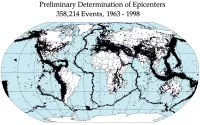
1963: Landslide-Tsunami Event at Vajont Dam
In 1963, a massive landslide from Monte Toc entered the reservoir behind the Vajont Dam in Italy, resulting in a wave that surged over the dam and destroyed several towns, killing around 2,000 people.
1963: Imamura-Iida intensity scale
In 1963, the Imamura-Iida intensity scale was introduced and used in the Pacific Ocean to measure the intensity of tsunamis.
1964: 1964 Alaska Earthquake
In 1964, the Alaska earthquake (Mw 9.2) generated a teletsunami that crossed entire oceans.
1969: Hawaii Five-O Episode
In 1969, an episode of the TV crime show Hawaii Five-O, titled "Forty Feet High and It Kills!", used the terms "tsunami" and "tidal wave" interchangeably.
1972: Soloviev's Modification
In 1972, Soloviev modified the Imamura-Iida intensity scale by calculating the tsunami intensity.
1977: 1977 Sumba event
The 1977 Sumba event, related to flexure in the outer trench swell, caused enough displacement to give rise to a significant tsunami.
March 1979: Meteotsunami at Nagasaki
On March 1979, a destructive meteotsunami occurred at Nagasaki.
July 12, 1993: Okushiri, Hokkaidō tsunami
On July 12, 1993, a tsunami struck Okushiri, Hokkaidō within minutes of an earthquake, creating waves as high as 30 meters. The port town of Aonae was overwhelmed, and wood-framed structures were destroyed, even though a tsunami wall was present.
1998: Papua New Guinea Tsunami
In 1998, the Papua New Guinea tsunami came from an earthquake which destabilised sediments, causing them to flow into the ocean and generate a tsunami.
2001: Tappin Study on Tsunamis
In 2001, Tappin released a study on tsunamis originating at locations away from convergent boundaries, including Storegga, Grand Banks in 1929, and Papua New Guinea in 1998.
2004: Animal behavior during the 2004 Indian Ocean earthquake
During the 2004 Indian Ocean earthquake, some media sources in Sri Lanka reported that animals sensed the tsunami and moved to higher ground. This has led zoologists to hypothesize that some animal species have an ability to sense subsonic Rayleigh waves from an earthquake or a tsunami, although the evidence is controversial and is not widely accepted.
2004: 2004 Indian Ocean Tsunami Drawback
In 2004, during the Indian Ocean tsunami, drawback was not reported on the African coast or any other east-facing coasts due to the initial wave moving downwards on the eastern side of the megathrust and upwards on the western side.
2004: Intensively Studied Tsunami
In 2004, following the intensively studied tsunami, the Integrated Tsunami Intensity Scale (ITIS-2012), a new 12-point scale, was proposed in 2013.
2004: Tilly Smith's Warning in Phuket
In 2004, ten-year-old Tilly Smith warned her family and others on Maikhao beach in Phuket, Thailand about the imminent 2004 Indian Ocean tsunami, saving dozens of lives.
2004: 2004 Indian Ocean Earthquake
In 2004, the Indian Ocean earthquake (Mw 9.2) generated a teletsunami that crossed entire oceans.
June 2006: Meteotsunami at Menorca
On June 2006, a destructive meteotsunami at Menorca caused damage in the tens of millions of euros.
2011: Intensively Studied Tsunami
In 2011, following the intensively studied tsunami, the Integrated Tsunami Intensity Scale (ITIS-2012), a new 12-point scale, was proposed in 2013.
2011: Fukushima Daiichi Nuclear Disaster
In 2011, the Fukushima Daiichi nuclear disaster was directly triggered by the Tōhoku earthquake and tsunami, where waves exceeded the plant's sea wall and flooded the emergency generators. Additionally, the 2011 tsunami toppled more than 50% of the tsunami barrier walls in Iwate Prefecture, causing catastrophic damage.
2011: 2011 Tōhoku Earthquake
In 2011, the Tōhoku earthquake (Mw 9.0) generated a teletsunami that crossed entire oceans.
2012: Integrated Tsunami Intensity Scale (ITIS-2012)
In 2012, the Integrated Tsunami Intensity Scale (ITIS-2012) was proposed.
2013: Introduction of the Integrated Tsunami Intensity Scale (ITIS-2012)
In 2013, following the intensively studied tsunamis in 2004 and 2011, the Integrated Tsunami Intensity Scale (ITIS-2012), a new 12-point scale, was proposed.
2018: Eruption and collapse of Anak Krakatoa
In 2018, the eruption and collapse of Anak Krakatoa killed 426 and injured thousands due to a tsunami, highlighting the need for better forecasting models and risk assessment.
2022: 2022 Hunga Tonga–Hunga Ha'apai eruption
In 2022 the Hunga Tonga–Hunga Ha'apai eruption triggered tsunamis.
Mentioned in this timeline

Nova Scotia is a province located in the Maritimes region...

Africa is the second-largest and second-most populous continent home to...
An earthquake is a sudden intense shaking of the Earth's...

Krakatoa or Krakatau is a caldera located in Indonesia's Sunda...

Trinitrotoluene TNT is a chemical compound C H NO CH...

Sicily the largest and most populous Mediterranean island is an...
Trending

4 hours ago Alejandro Tabilo Competes at the Mubadala Citi Open in Washington

4 hours ago Bruce Willis Reflects on Challenging Production of Forgotten 1990s Films

4 hours ago Denver Nuggets Offer Peyton Watson Five-Year Seventy Million Dollar Extension

4 hours ago Peyton Stearns Defeats Mary Stoiana at WTA Memphis Open

4 hours ago Chicago White Sox Face New York Yankees in Latest MLB Matchup

5 hours ago Debate Intensifies Over 2026 NL Rookie of the Year Favorite
Popular

Rand Paul is an American politician and the junior United...

Anthony Stephen Fauci is a prominent American physician-scientist and immunologist...

Lindsey Graham is a prominent American politician serving as the...

Johnny Depp is a highly successful American actor musician and...

Josh Hawley is an American politician and attorney currently serving...

LeBron James nicknamed King James is an American professional basketball...